Each map shows the burned areas, the severity of the burn, and in most maps, the very low and unburned areas within the fire perimeter. Combined across the complex of the six fires the BAER team is analyzing, less than 1% of the burn was extreme. By contrast, 38% of the area within the fires was very low or unburned.
This first map is an overview of the six fires the BAER team are developing a report for. The fires they are analyzing are:
- Maple Springs Fire
- Dick's Creek Fire
- Tellico Fire
- Camp Branch Fire
- Knob Fire
- Boteler Fire
Each fire has a Burned Area Severity map. NOTE: Each map has the total burned severity of all the fires in the complex as it's legend. Each map does not have it's own individual analysis.
Overiew Map - this shows all of the fires in complex being analyzed.
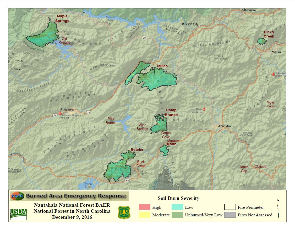
For a downloadable, printable version of the overview map, click here.
Here is the burn severity map for the Maple Springs Fire -

For a downloadable, printable version of this map, click here.
Here is the burn severity map for the Dick's Creek Fire -

For a downloadable, printable version of this fire, click here.
Here is the burn severity map for the Tellico Fire -

For a downloadable, printable version of this fire, click here.
Here is the burn severity map for the Camp Branch Fire.

For a downloadable, printable version of this map, click here.
Here is the burn severity map for the Knob Fire -

For a downloadable, printable version of this map, click here.
Here is the burn severity map for the Boteler Fire -

For a downloadable, printable version of this map, click here.
No comments:
Post a Comment